L o a d i n g
Organization
National Oceanic and Atmospheric Administration - view all
Update frequencyunknown
Last updated3 years ago
OverviewOcean Temperaturesalinityweather buoys
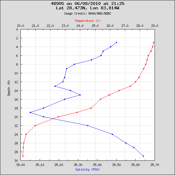
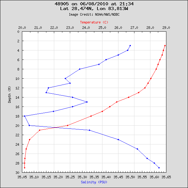
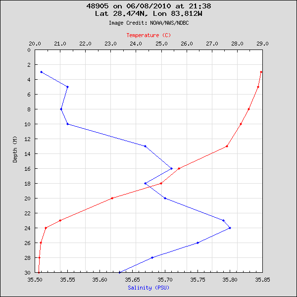
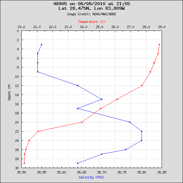
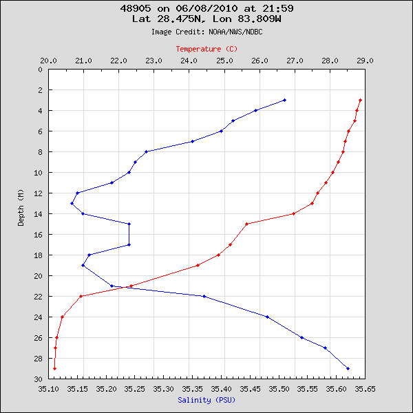
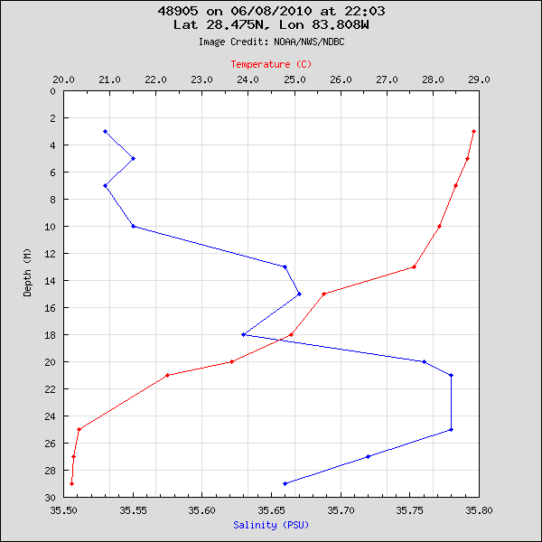
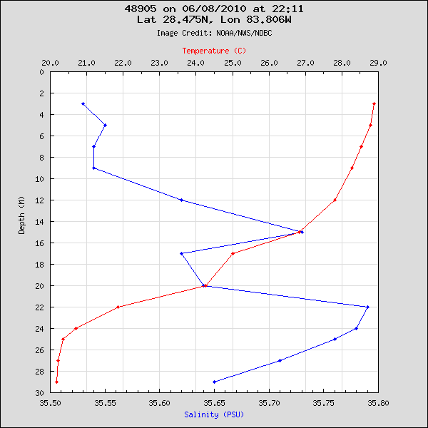
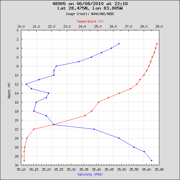
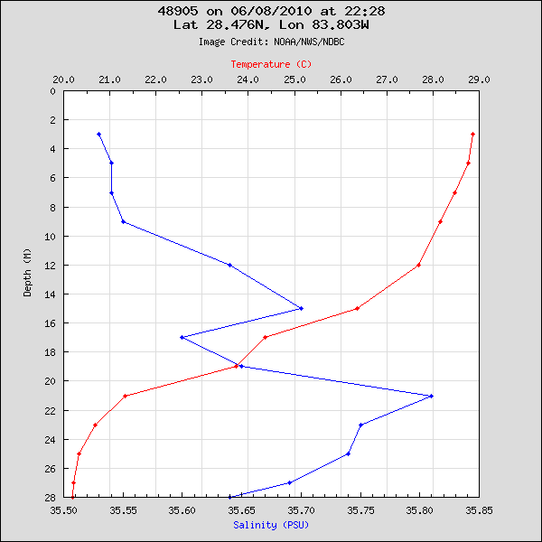
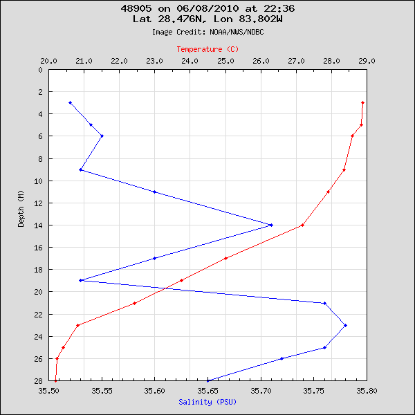
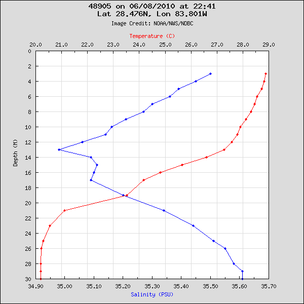
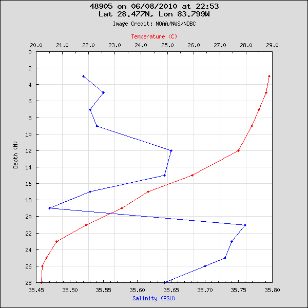
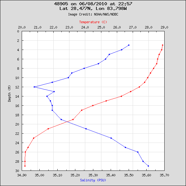
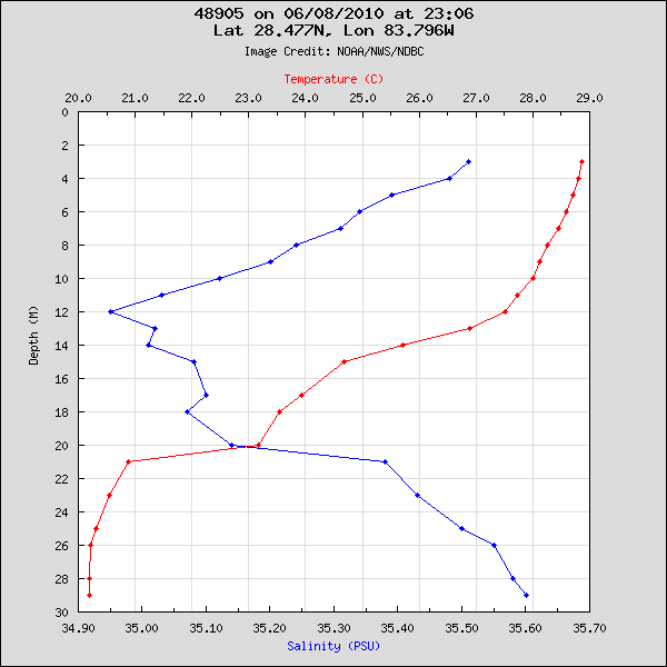
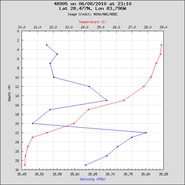
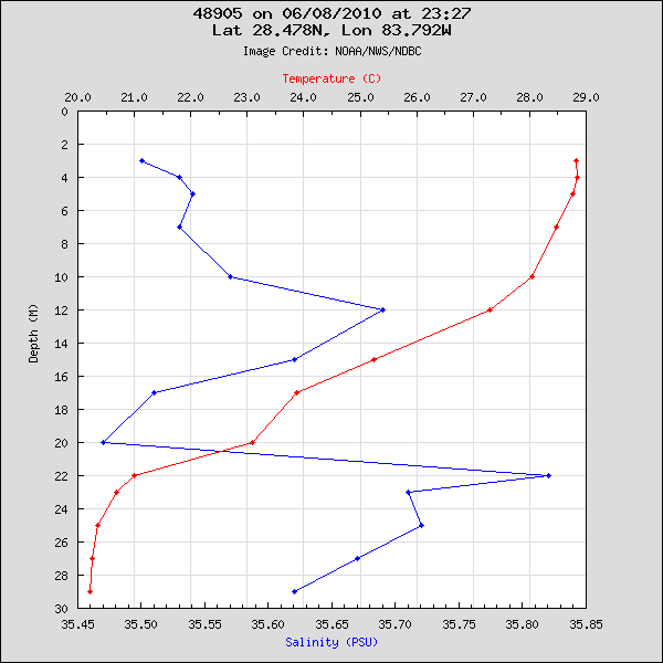
National Data Buoy Center historical plot data (graphs, charts) with ocean salinity/depth/temperature information recorded at station number 48905, owned and operated by COMPS (University of Southern Florida), from the period June 8, 2010 through July 12, 2010. https://web.archive.org/web/*/https://drp-upload-bagger.s3.amazonaws.com/remote/DA7C922C-A32B-4380-B8E2-F5DA009A7A0F.zip