L o a d i n g
OverviewL1L2L3SydneyTransportationguideguideslight raillightrailnetworkstopsystemtransport
The Sydney light rail network is a light rail system serving the Australian city of Sydney. The network currently consists of three passenger routes, the L1 Dulwich Hill, L2 Randwick and L3 Kingsford lines. This dataset provides WCAG 2.0 compliant wayfinding maps for 42 Sydney light rail stops. Each map displays the local area map and the stop map providing information such as transport connections, customer assistance and tickets. **Current Sydney light rail network** 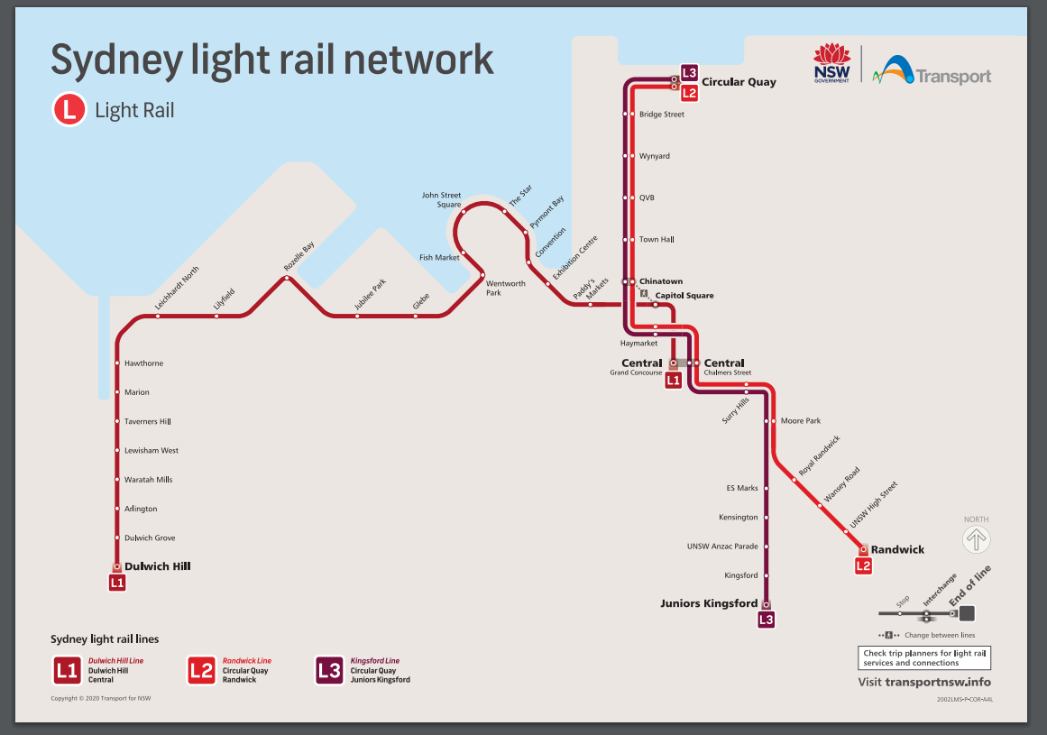
Additional Information
KeyValue
Harvest Object Id96f8b1a8-3557-40fc-bf31-614308ace502
Harvest Source Iddf858780-376c-4c35-8914-1e33d0336116
Harvest Source TitleTransport for NSW Open Data Hub